Few places in North America rival the raw beauty and ecological richness of the Greater Yellowstone Ecosystem (GYE). Spanning nearly 22 million acres across northwest Wyoming, southern Montana, and eastern Idaho, this vast and diverse landscape is a sanctuary for wildlife, a mosaic of geological marvels, and a living canvas that changes with the seasons. And for aerial photographers, it’s nothing short of a dream.
Why the Greater Yellowstone Ecosystem?
The GYE is one of the largest nearly intact temperate-zone ecosystems on Earth. It includes Yellowstone and Grand Teton National Parks, as well as surrounding national forests and private lands. From the steaming geothermal basins of Yellowstone to the jagged peaks of the Tetons and the sweeping valleys teeming with bison, elk, and wolves, the region offers a dynamic range of subject matter that’s best appreciated from above.
Aerial photography unlocks a rare perspective—one that reveals the interconnectedness of these landscapes. It transforms winding rivers into ribbons of light, geyser basins into abstract patterns, and forest fire scars into natural mosaics.
Tools of the Trade
Modern aerial photography in the GYE demands careful planning and respect for the environment regulations:
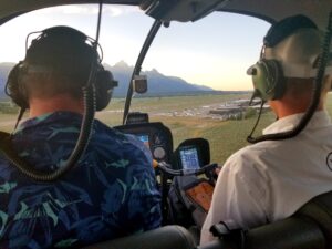
Helicopters: For professionals with access to manned flight, chartered Aerial Photography flights offer legal and unobtrusive means to photograph large swaths of the GYE, often used in conservation and documentary work.
Ethics: The goal is always to capture – never disturb. Altitudes and subjects are carefully considered and flights carefully planned to avoid impacts to resources, people and most importantly wildlife.
Seasons from the Sky
Each season brings unique photographic opportunities in the GYE:
Spring: Melting snow and swelling rivers paint the landscape with dramatic contrasts. Bright green meadows emerge amid lingering snow patches.
Summer: Wildflowers bloom across alpine meadows, geyser basins shimmer in full color, and the clear skies provide the best flying conditions. This is the high season for aerial photography.
Fall: The aspen groves and cottonwood trees explode with color, casting golden reflections in rivers and lakes.
Winter: Snow blankets the landscape, reducing it to elemental forms and shadows. Thermal features stand out vividly against the white backdrop, and aerial views often reveal the only signs of movement in an otherwise frozen world.
Conservation Through Aerial Imagery
Aerial photography is more than art—it’s a tool for advocacy. Images of the Greater Yellowstone Ecosystem from above can illustrate habitat connectivity, the effects of wildfires or glacial retreat. Conservation groups often use aerial photography to document land-use changes, illegal developments, or to promote land protection initiatives.
Final Thoughts
Aerial photography in the Greater Yellowstone Ecosystem is a powerful way to tell the story of a wild, breathing landscape. It’s an opportunity to witness Earth as the birds do—soaring above geysers, glaciers, and herds—and to remind ourselves of the vast, interconnected web of life below. The aerial approach to photography leaves nothing behind.
Whether you’re a seasoned aerial photographer or a nature lover dreaming of learning a new skill, the GYE offers a perspective that’s not just breathtaking—but deeply humbling.
Tips for First-Time Aerial Photographers in the GYE:
Always chose a provider with experience and understanding of flying Aerial Photography in the region.
Never Disturb wildlife! Wildlife Photography is not an aerial game, its a ground game.
Flying with low-impact ethics in mind: keep your distance, minimize noise, and prioritize safety.
Consider collaborating with conservation organizations to give your work a deeper impact.
Nature looks different from above—sometimes more vulnerable, always more majestic. In the Greater Yellowstone Ecosystem, that view can inspire a lifetime of respect and wonder.